Travel, Tourism, and the Transmission of Knowledge in and around Japan
August 26th, 2025How was knowledge, ranging from the scientific, pious, entrepreneurial, and artistic, to the preposterous, transmitted through the historic movement of print and manuscript material in and around Japan?
Setting out to tackle this question in Spring 2025, students in the University of Kansas History of Art Department Japanese art history seminar “Manuscripts, Maps, and Illustrated Books” had the opportunity to curate this exhibition, working with materials from The Kenneth Spencer Research Library collection. Selected works range from 1646 to 1936, including detailed cartography, woodblock-printed imagery, and religious paraphernalia. Journeying from Japan to the West and back again, this exhibition spans three centuries and five intersecting themes.
Opened on July 31, 2025, the exhibition’s five cases follow the themes given below. In addition, a special event in the gallery on Wednesday, September 3, 2025 (3:30-4:45) will feature mini presentations on selected works by each seminar student. The exhibit will remain open through January 9, 2026.
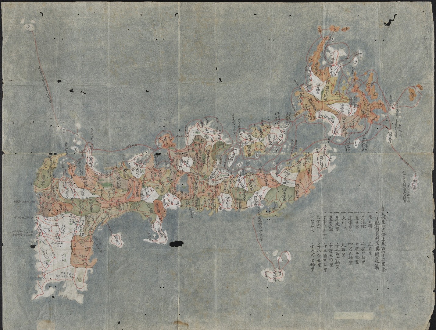
1. Mapping and Conceptions of Space demonstrates that as Japan moved toward the 19th century, its awareness of the world beyond its islands gradually increased. Interactions with foreign visitors fostered an exchange of culture and knowledge that diffused into every area of society, including Japanese cartographic practices.
Representations of space in both image and text indicate the geographical information deemed most important. From spiritual landmarks and cosmological beliefs to political boundaries and travel logistics, these historical maps and guides reveal how users’ conceptions of East Asia were shaped at the time.
While overseas travel remained restricted throughout the 17th to 19th centuries, these materials demonstrate an expanding awareness of domestic and global geographies, depicted using both traditional Japanese mapmaking and novel observations from Western travelers.
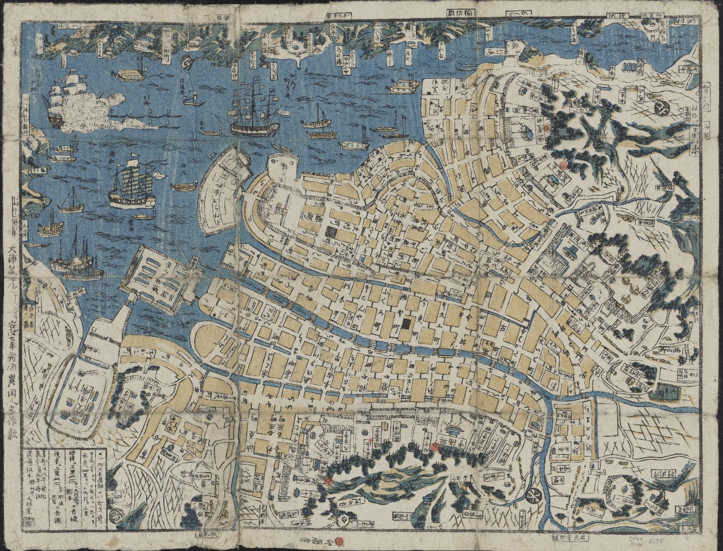
2. Tourism and Movement of People explores how travel shaped the visual culture and national identity of Japan from the seventeenth century through the turn of the 20th century. The depictions of elaborate 17th-to 19th-century processions of feudal lords evoke an earlier era of ceremonial travel and spectacle, emphasizing traditional routes and social hierarchies.
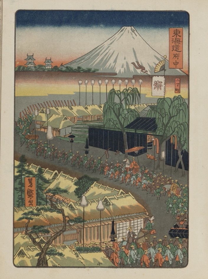
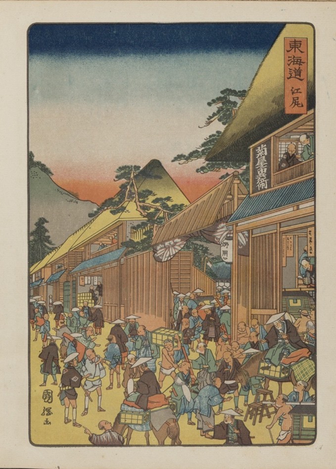
Hiroshige Toyokuni meiga hyakushu daimyō dōchū 広重豊国名画百種大名道中
(One Hundred Famous Views of a Daimyo’s Journey by Hiroshige and Toyokuni). Tokyo: Tōkōen, 1918. Call Number: E3579. Click image to enlarge.
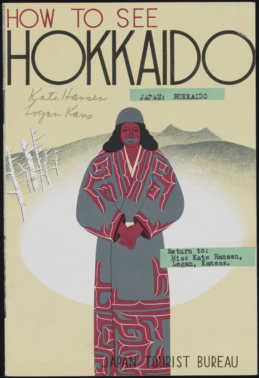
By the early 20th century, Japan’s interest in travel shifted toward promoting tourism as a tool for modernization and imperial expansion into regions such as Manchuria (Northeast China), Hokkaido and Korea. Postcards, travel guidebooks, and government-issued pamphlets offered carefully curated images and structured itineraries for both foreign and domestic travelers.
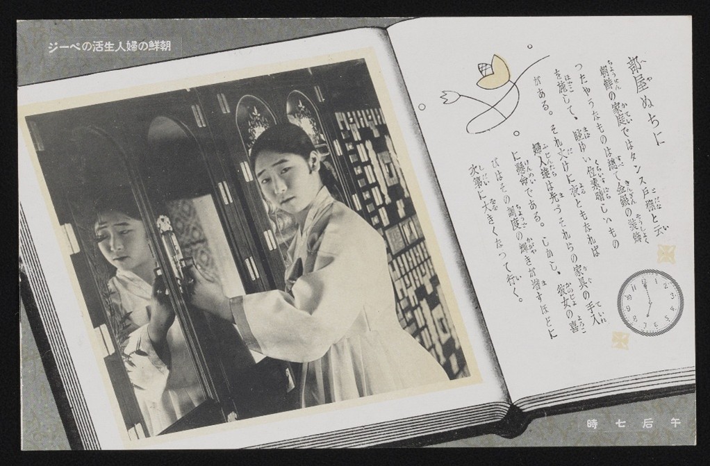
Together, these materials illustrate changing conceptions of travel, from symbolic displays of authority to strategic assertions of national identity.
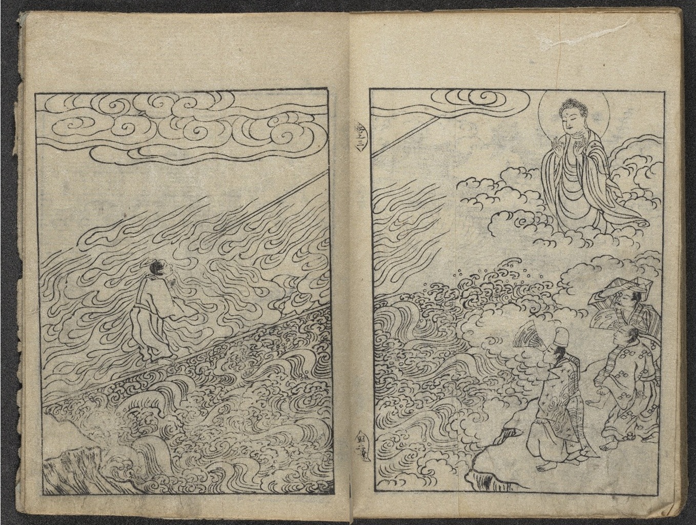
3. Pilgrimage and Movement of Religions reflects upon the spread of foreign faiths to Japan, as well as the pivotal role of bodily and spiritual journeys within religious beliefs and practices. Originating in India, Buddhism spread to Japan in the sixth century and since developed into a major religion with a profound influence on daily life. Buddhist practitioners frequently visit temples and undertake pilgrimages along designated routes, seeking face-to-face encounters with deities through their icons.
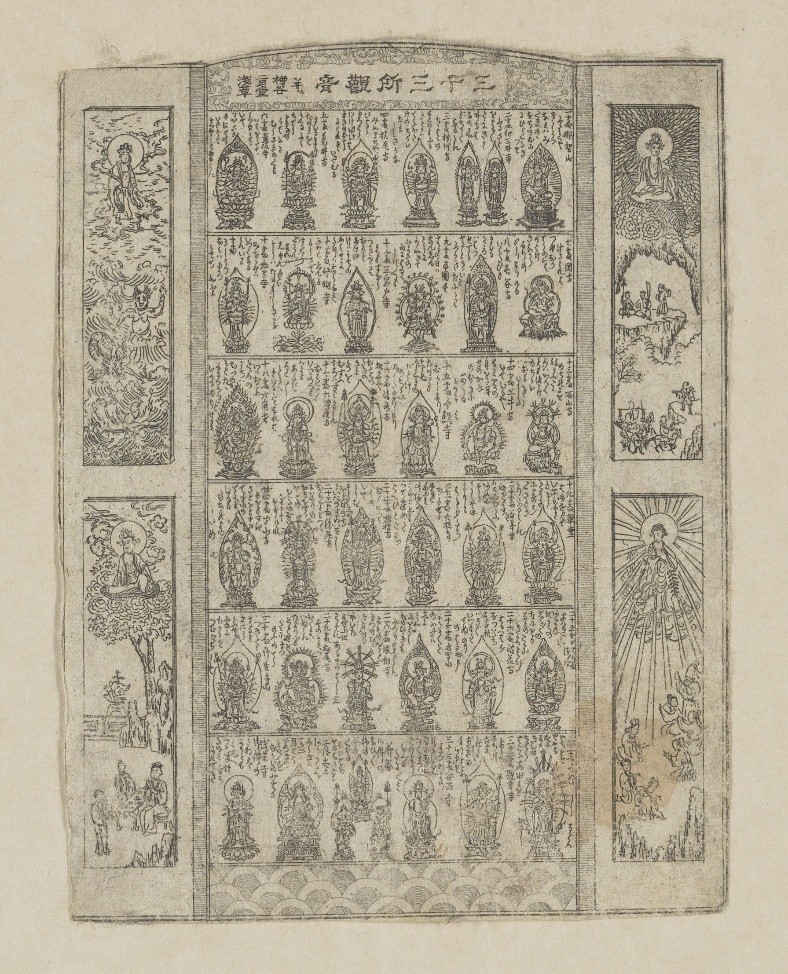
Sanjūsansho Kannon narabini Yanagidani Nigatsudō Asakusa 三十三所観音 并二 柳谷二月堂浅草 (Thirty-three Kannon Pilgrimage Sites with Yanagidani, Nigatsudō, and Asakusa). Japan, ca. 1860–1868. Call Number: P363. Click image to enlarge.
In many legends, sacred Buddhist icons demonstrate miraculous power and compassion by journeying across land and sea. Movement occurs not only across geographical spaces, but also between the earthly realm and Buddhist paradises.
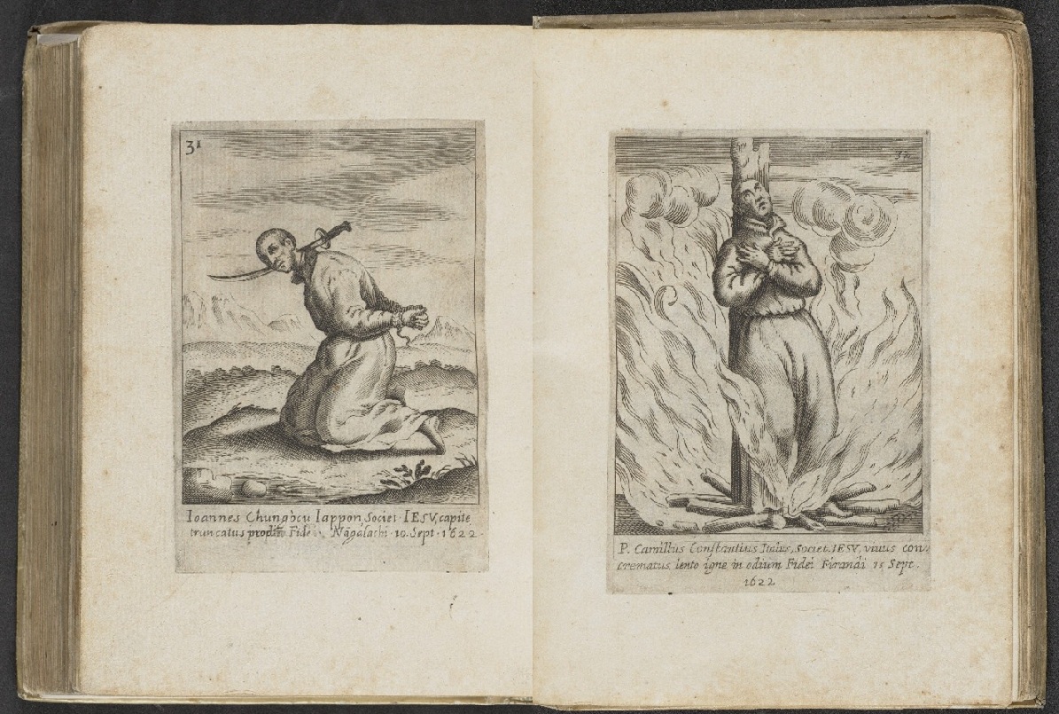
However, not all foreign religions were warmly received in Japan. A few decades after its introduction by Jesuit missionaries, Christianity faced severe persecutions in the late 16th and 17th centuries, reflecting state and local resistance to beliefs imported from distant shores.
4. Trade and Movement of Goods offers a window into the commercial world of Japan and the global trade networks that developed from the movement of goods. Print culture in Japan served not only to document commodities but also to shape how goods were seen, valued, and consumed. From tea catalogs to textile pattern books and beer advertisements, the objects in this case reveal how trade goods were embedded in shifting notions of taste, identity, and national power.
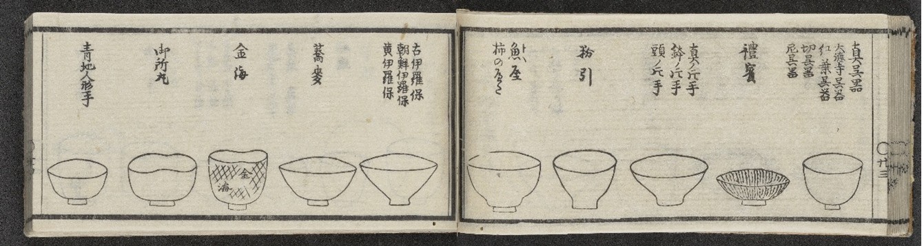
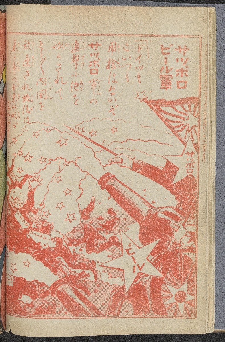
Although trade across East Asia dates back millennia, commercial exchange between Japan and the West began to grow from the 17th century and intensified at the turn of the 20th century. With objects and knowledge flowing between Japan, broader Asia, and the West, print media itself became a commodity, as demand for Japanese goods expanded. These publications offer a window into the commercial world of Japan, its transnational material culture, and the global trade networks that developed from the movement of goods.
5. Virtual Travel and Fantasies of Asia examines printed materials from the 17th to the 20th century that depicted Japan’s culture and shaped Western fantasies of Asia, constructing descriptions that blurred fact and fiction.
![Image of a plantlike figure representing the Buddhist deity Avalokiteshvara in Gedenkwaerdige gesantschappen der Oost-Indische maatschappy in’t Vereenigde Nederland, aan de kaisaren van Japan (Atlas Japannensis [Japanese Atlas]).](https://blogs.lib.ku.edu/spencer/wp-content/uploads/2025/08/Picture11.jpg)
Through these objects, virtual travel, the concept of journeying to another place through imagination, was made possible for Europeans and Americans alike.
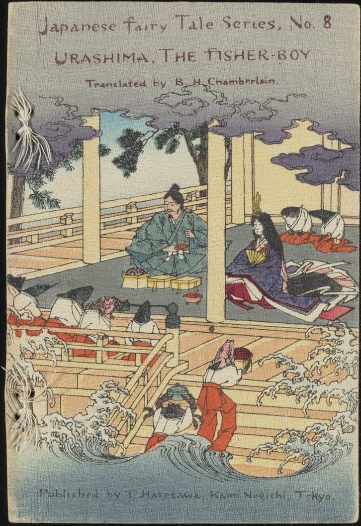
Japan also capitalized on print media, seeking to reconstruct its self-image as modern and legitimize its global relevance in the 20th century. These books, fashion plates, and inventive illustrations reveal the breadth of cultural dialogue between East and West, offering visions of Japan in which curiosity, exoticization, and national identity came together.
These treasures that traveled out of The Kenneth Spencer Research Library stacks into this exhibition represent but a fraction of the library’s holdings of Asian material, which are all available upon patron request. Notably, several of the items included were collected by Kate Hansen (1879–1968), a Kansan who lived in Japan as a missionary and music teacher during 1907–1941 and 1947–1951.
After finalizing the exhibition details, a new acquisition was made to the library’s collection that fit the exhibition theme so well we decided to add it to a bonus case. Please come look for this wonderful mystery item. Hint: polar bears!
We hope that these displays will move viewers to appreciate how people of the past sought creative strategies that blended image with text to excite and inspire the transmission of knowledge in and around Japan.
Sherry Fowler (drawing from collaborative exhibition text)
Professor of Japanese Art History, History of Art
University of Kansas
*****
Faculty advisor: Sherry Fowler, Professor of Japanese Art History, History of Art, University of Kansas
Student curators: Yuan-Hsi Chao, Brady Cullen, Aria Diao, Shangyi Lyu, Olivia Song, Emma Smith, Rebekah Staton, Heeryun Suh, Eli Troen, and Morgan Williamson
Library advisor: Eve Wolynes, Special Collections Curator, University of Kansas Libraries
*****