January 1, 1804: Haiti Declares Independence
January 1st, 2019January 1st is celebrated in both the United States and Haiti as the start of the New Year, but it is an important holiday in Haiti for another reason. January 1st is the day in 1804 that Haiti declared its independence from colonial rule. Freeing itself from French control, Haiti became the first nation to be founded by formerly-enslaved people having successfully revolted through a series of uprisings starting in 1791.
Haiti is the focus of the 2018-2019 KU Common Book, a shared reading experience that is part of the university’s First-Year programming. In the selected book, Create Dangerously: The Immigrant Artist at Work, the author Edwidge Danticat points out that the United States did not immediately recognize Haiti as a free state. Thomas Jefferson, President of the United States from 1801 to 1809, expressed concerns about the impact the slave revolt in Haiti might have on the U.S. A brief overview of the American political perspectives on the Haitian Revolution is available online from the Office of the Historian of the United States Department of State.
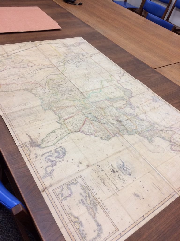
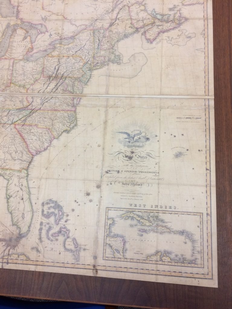
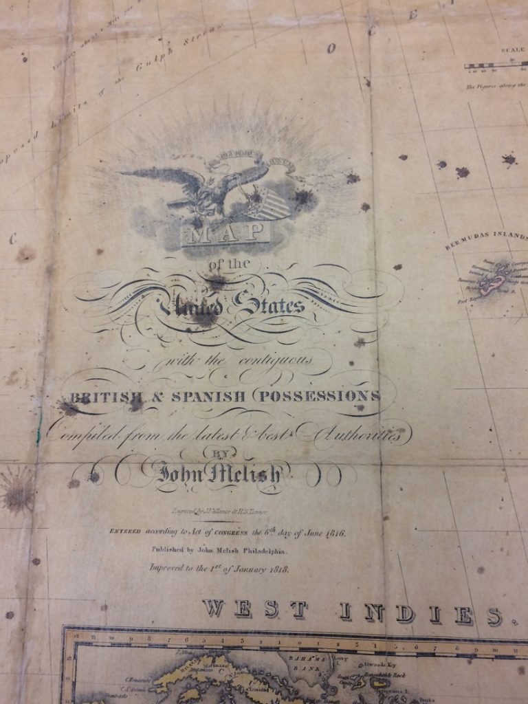
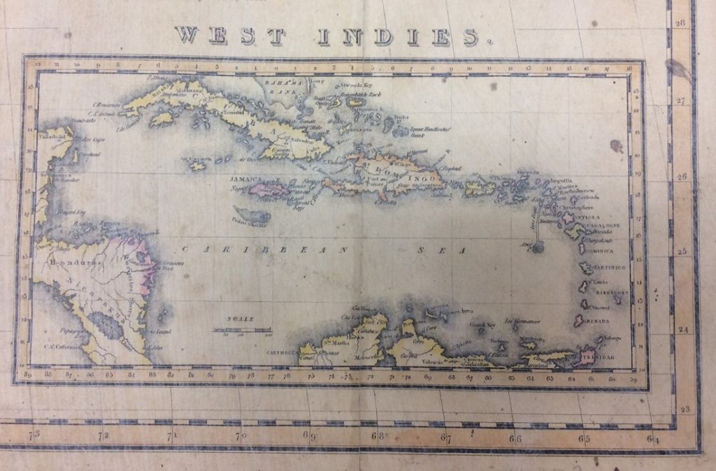
Historic maps often interestingly reflect a particular political perspective. The map shown below is from Spencer Research Library’s Special Collections. It is a map of the United States published in 1816 (and “improved to the 1st of January 1818”) in Philadelphia. The map includes “the contiguous British and Spanish possessions” and has an inset of the West Indies.
The map (top) with closeups of its title (bottom), which reads as follows: “Map of the United States with the
contiguous British & Spanish possessions / Compiled from the latest & best Authorities by John Melish / Entered
according to Act of Congress the 6th day of June 1816. / Published by John Melish Philadelphia. / Improved
to the 1st of January 1818.” Call Number: N8 Orbis #127. Click images to enlarge.
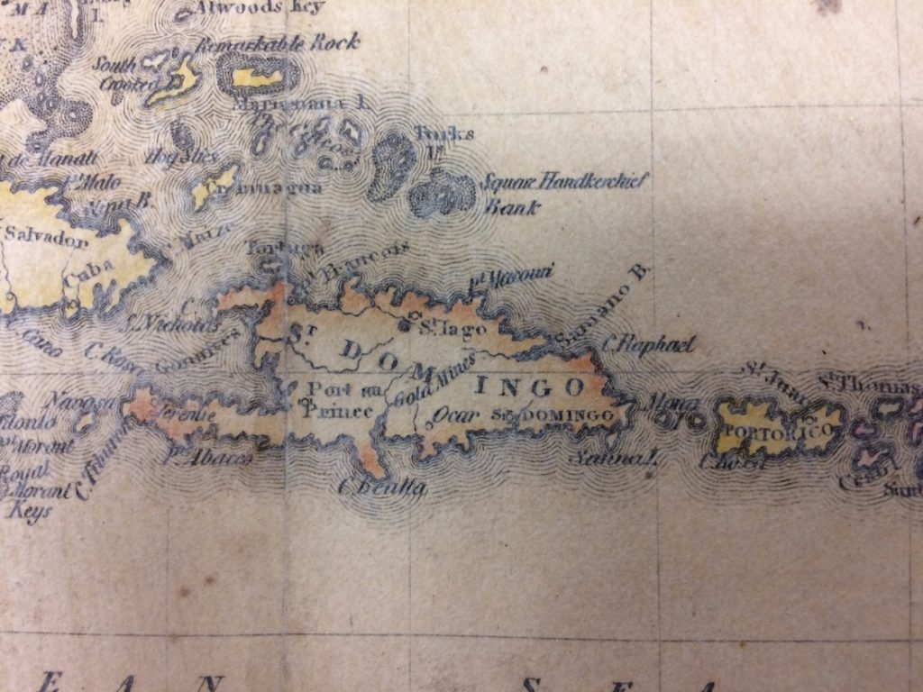
An inset showing the West Indies (top) and a closeup of “St. Domingo” (bottom).
Modern-day Haiti occupies the western side of the island of Hispaniola.
The eastern side is the Dominican Republic. Hispaniola is part of the Greater Antilles
in the West Indies. Call Number: N8 Orbis #127. Click images to enlarge.
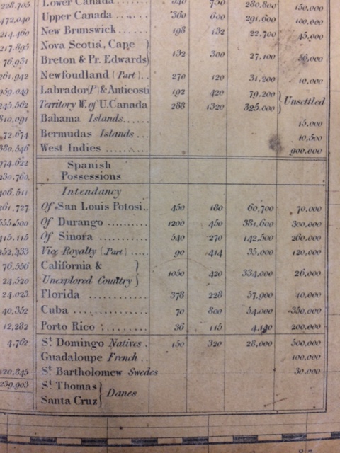
Although Haiti had established itself as a republic in 1804 and had discarded its former name as the French colony of Saint-Domingue, this American map from 1816 shows the entire island of Hispaniola labeled as “St. Domingo.” A “Statistical Table of the Several Countries Exhibited on the Map” (shown below) includes the states and territories of the United States and other countries with the subcategories of British possessions, Spanish possessions, and an unlabeled grouping that lists St. Domingo as controlled by “Natives,” Guadaloupe controlled by the French, St. Bartholomew controlled by the Swedes, and St. Thomas and Santa Cruz controlled by the Danes.
The map’s statistical table. Call Number: N8 Orbis #127. Click images to enlarge.
It was not until 1862, during the presidency of Abraham Lincoln, that the United States government officially recognized Haitian independence.
Stacey Wiens
Reference Specialist
Public Services
The Hindu Coupons are designed to save you money when you shop online. This store offers a wide variety of products that are made by reputable brands. They often show a large number of coupon campaigns, which can save you a lot of money on items you would otherwise purchase. You can also get discounts on items if you spend a certain amount.

